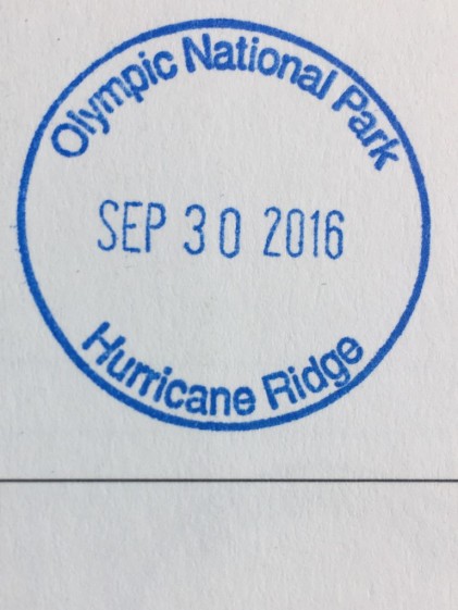
NPOTA Entity: Olympic National Park NP44
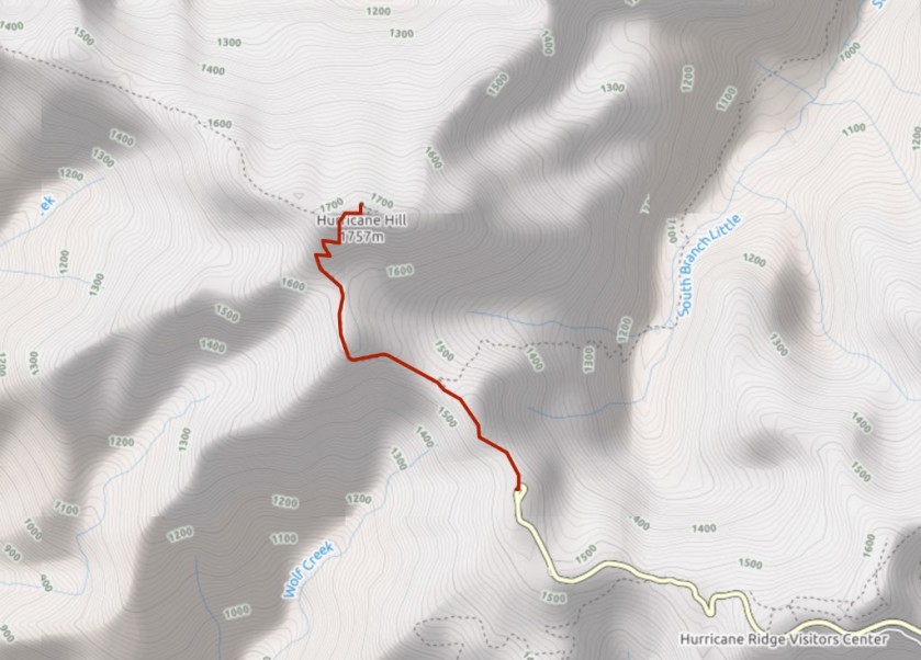
SOTA summit: Hurricane Hill W7W/NO-086
Activation Date: Sept 30, 2016
Portable operation: Yes
Radio: Elecraft KX2 operating at 10 watts
Antenna: LNR Trail Friendly end fed 40-10m
Bands used: 20m and 40m
Furthest QSO: ~2,500 miles with K2JB in North Carolina
Hike in: Yes, ~3.2 miles roundtrip and 500 ft of ascent
Solo operation: No, with Guy (N7UN/NS0TA)
Recommend: Yes
ATT Coverage: Excellent
Photos: Copyright Paul Gacek 2016
That little red light has come on. You know, the one that indicates your about to run out of fuel in your car. “Oh yes”, we said to each other, “we forgot to get gas!”. Clearly, our rather large breakfast impaired our mental capacity earlier. We’re deep inside Olympic National Park and only about a million miles from the nearest gas station. Getting to the trail head isn’t really the issue albeit further away from a gas station but more getting to the gas station later. We take comfort in the fact that the return journey is down hill and if the worst comes to the worst we can coast down the hill.
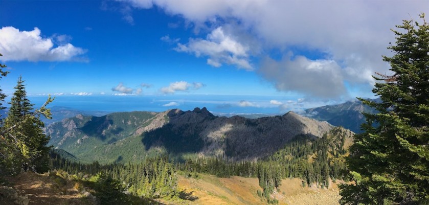
The trail is easy to follow and very popular. We are a friendly pair and say hi to most everyone we pass. We see couples carrying new arrivals in backpack style infant carriers. We see the old and infirmed enjoying this beautiful part of the world on an equally beautiful day. We see the young, the happy. The great outdoors in doing its magic and lifting people up.
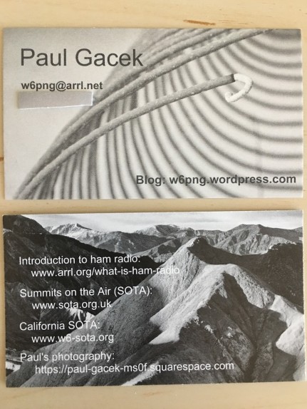
Setting up shop on the highest point finds us chatting with so many people who are curious what we are up to. We hear whispers that its a weather station, others a permanent fixture before mustering the courage to ask us directly. Eye contact and a smile from either of us melts our unannounced visitors apprehension. Most everyone enjoys the story of what we are doing. Maybe its the fact that people like a single passion but find something magical when two passions collide in such a healthy and positive way. Guy and I tell the story differently but with the same intent on conveying the fun and hoping to win converts. Sometimes I sell the hiking aspect and how I have visited places I would never normally go yielding so many unexpected sights and delights. Sometimes that my radio passion as a kid helped shape my career choice and how fortunate I have been in the tech industry. Maybe its the social side. I always close with giving them my “business” card that points them to SOTA sites, how to become a ham site and of course my blog!


So how did the trip back to a gas station go? Or are you still up on the hill? 😛
LikeLike
The rental car had better than expected gas mileage, so that plus the down hill aspect had us make it safely to Port Angeles and a gas station.
LikeLike
Paul, Most fuel Gauges indicate F when full and E for Enough; Anything in between is more than enough! Enough for what I am not sure?
Noticed that you must have a National Parks Passport? Only discovered this when at Mt. Rainier N.P and was wondering if you know about ways to get stamps from the parks we had already visited?
Thanks for the read, Tony VK3CAT
LikeLike
Fun story!
LikeLike
Once again you have captured the lure of the outdoors and hiking making it something that we should definitely experience for ourselves. I like your “business card” and think that this is a great idea, something worth copying to encourage newcomers to our hobby.
LikeLike