NPOTA Entity: NP41
SOTA summit: W7W/RS-050
Activation Date: June 6th, 2016
Portable operation: Yes
Radio: Elecraft KX2 operating at 10 watts
Antenna: LNR Trail Friendly end fed 40-10m
Bands used: 20m
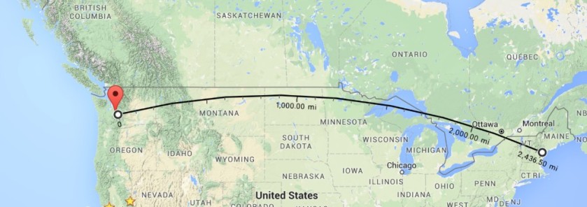
Furthest QSO: ~2,500 with K1KA in New Hampshire using SSB at 10 watts
Hike in: Yes
Solo operation: No, with Guy N7UN
Recommend: Yes. Incredible views, somewhat strenuous but easy to follow pretty trail
ATT Coverage: Great
Photos: Copyright Paul Gacek 2016
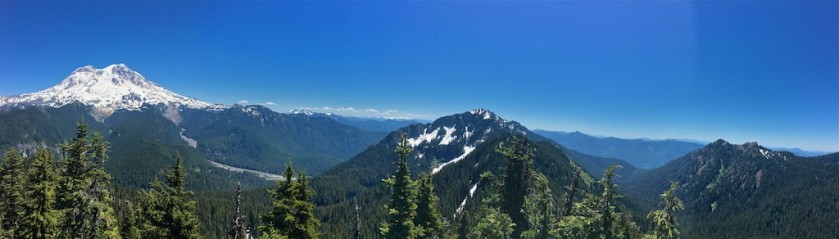
Mount Rainier is unmistakable and dominates the landscape for miles around but its been robbed by Whitney and two other co-conspirators of the honor of being the highest in the lower 48. It’s only lost out by 80 or so feet but unlike Whitney that is flanked by supporters and competitors, Rainier stands alone and shows it enormous prominence that has Whitney beat.


Somewhere off Interstate 5 we stop for breakfast. The place is empty and has a distinct look of the 1970s. Its a diner like so many others that have a knack for producing a meal that at points is delicious and moments later mundane and boring. Maybe its the coffee thats most bland but I didn’t really notice as Guy is walking me through the salient points of N1MM, a piece of software that all self respecting hams must know and must use. I’m a novice but watching Guy the day before at Dismal Nitch seamlessly decode CW in his head and then equally gracefully type call signs and evoke responses from within N1MM has me sold, hook line and sinker. We hurriedly pay and head out realizing we are now behind schedule.
Passing through the iconic west entrance to Mount Rainier NP we head north on the best groomed dirt road that money can by. No washboarding, no ruts and distinctly better than any main thoroughfare in the People’s Republic of San Francisco that likes to tax but not give back.
We hike past a gate along a fire road only to realize we have left our maps in the car. The confident and experienced hikers that we are, we consider this not much of any issue as we know the trail to Gobbler’s Knob is just round the corner and on our right. Well just round the next corner and on our right, err the next one and on our right…..
We see a sign and feel vindicated but sadly its a memorial to 32 Marines that perished when their plane crashed into Rainier in the late 1940s. Someone has thoughtfully placed what seems like 32 new US flags and we stop and reflect on all of this.

We find a trail head and follow the trail into the forest heading down and down. This did strike us as odd as we were really trying to get somewhere that is up and up. We convince ourselves the peak in front of us whose face is just like a wall climbing countless thousands of feet up is our destination. The trail doubles back and we reach an intersection and in the corner of our eye we see our fire road again. Uhmm…upon closer inspection of the only thing that comes close to a map on my iPhone we realize right should have been left at the Marine memorial and that we have now added 2 miles for a total of 13 miles round trip to Gobblers Knob and another hour behind schedule.
The fire lookout building is classic I setup shop on the upper deck. Legs dangling over the side, end fed drooping past me and operate to the strains of Ukrainian below me as two other visitors enjoy the same breathtaking view of Rainier. Something like eight glaciers cling to its peak giving it its year round frosted and frozen look. Possibly one of the most awe inspiring activation areas to date. Twenty seven minutes and forty contacts later I hustle to pack up ever mindful of the time.
Guy and I are on a forced march down the trail.
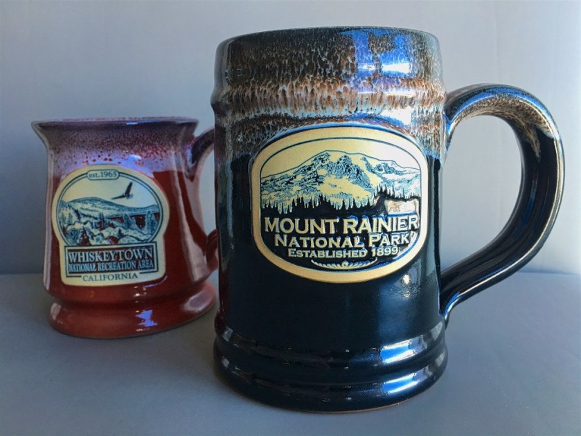
I take my National Park visits very seriously and none are complete without a stamp and a mug. Unfortunately our lingering at breakfast and trail detour has put us seriously behind schedule. I have 45 minutes or so to get to Paradise, the only ranger station/shop open in the park. The windy road on the map looks bad enough and the sedate sightseers that claim to be drivers, all add to the drama as we crawl, lurch, twist, climb and ultimately arrive at ranger GHQ. Dancing across torrents of glacier run off that paints patterns in the parking lot, I dash in and grab my stamp and am told the store is closing then and there. I’m sunk, I’m out of luck. However, as serendipity would have it Paradise Lodge has a store open a few more hours more and unlike the NPS store it sells my much coveted Deneen mug which is big and dwarves my California ones.
Take that Whitney!


Hi Paul, an interesting read shame about the extra miles. Our fire lookout towers are out of bounds, steel padlocked gates preventing access to the general public. Great photos thanks for sharing your adventure. Cheers Andrew VK1AD
LikeLike
Andrew, that’s unfortunate about fire look outs in Australia. For the few that are stilled operated you can typically go in and get a “tour”.
Paul
LikeLike
Great site. Good, informative format and commentary. Nice photography.
LikeLike
Another great adventure described. A hiker should really never be without a map of where he is going. You are lucky that you made it and did not get lost. Glad you did make it and posted it. What are you going to do with all these mugs?
Terry K6MA
LikeLike
I try and use a different mug each morning and its nice to be reminded each day of a different place I have visited. However, the acquisition program isn’t very scalable and so I will focus purely on classic NP properties (Yosemite, Lassen etc) hereon out.
No map was unfortunate but fortunately the chance of getting “life threateningly lost” was low.
LikeLike
Great site, Paul. I enjoyed our talks at SEAPAC, even buying an FT-817 and doing a qrp solo field day from a nearby state park. A favor: I can’t find the contact info you provided for the OR NPOTA coordinator. I’m interested in going along on an activation, and maybe in doing one of my own (probably Oregon Caves National Monument). Thanks again for the talks and the inspiration they provided me!
Andrew Ellis NO6E
Rogue River, OR
LikeLike
Andrew, thanks and I sent you an email with Etienne’s (W7O AM) details.
LikeLike
Hi Paul;
With your gift of writing down your descriptive thoughts for others top enjoy and travel along with you, let me assure it I for one enjoyed your efforts. I’ll bet this post went over two hour time limit.
Larry
Baden Powell
LikeLike
Hi Larry, it was great to meet you yesterday. I’ve worked into the 2 hr limit one the last year and many of the earlier posts were much longer but this was hopefully around 2 hours. Glad you enjoyed the read. Have fun on your upcoming rambles across the seven western states and if you want to talk about blogging/Wordpress don’t hesitate to reach out, Paul
LikeLike