Summit: W6/NS-147
Activation Date: October 20, 2015
ATT Data Coverage: Excellent
ATT Voice coverage: Not sure but presumed to be excellent
APRS Coverage: Not sure
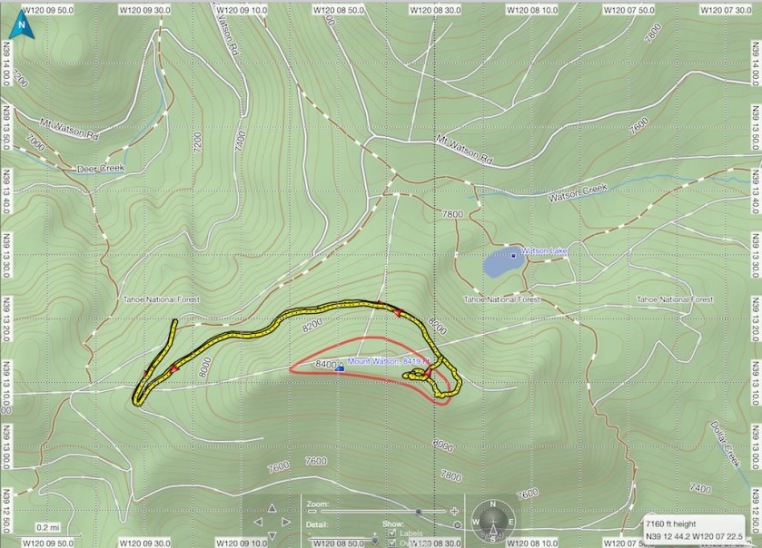
Access: Drive Watson Rd (paved) ~6.6 miles from 267. Park/trail head at N39 13’18 W120 09’25
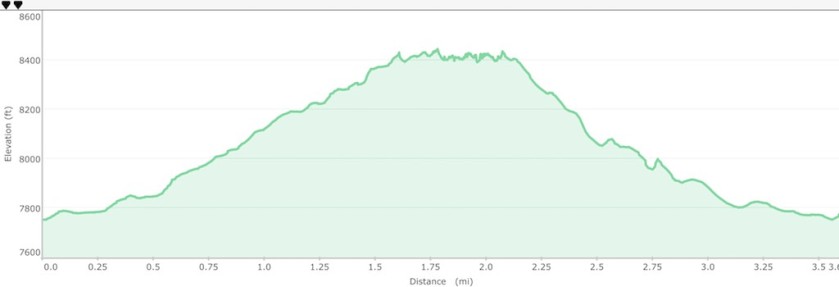
Hike stats: 3.6 miles roundtrip and 1,000′ of ascent up to 8,424′, walk on dirt road and semi-exposed treed summit.
Light danced through the trees in my rear view mirror and for a moment I wondered who else was mad enough to be on this remote forest road so early, only to realize it was dawn breaking through the trees. This definitely felt like zero dark thirty made all the more adventurous with an ambient temperature hovering around 32F.
Excitement and anxiety are opposite emotions sometimes hard to distinguish. Never more so today as this trip had a number of firsts for me; five planned activations over two days, all solo and in an area new to me. Consequently, the previous night had been restless and the familiar sheep counting had been replaced by visions of bears on the trail!
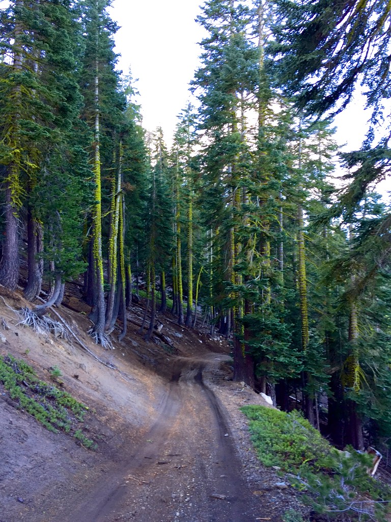
The trail cuts a path through a pine forest that offers glimpses of views across the mountains punctuated by frosted vistas into the forest that conjures up thoughts of the Hobbit.
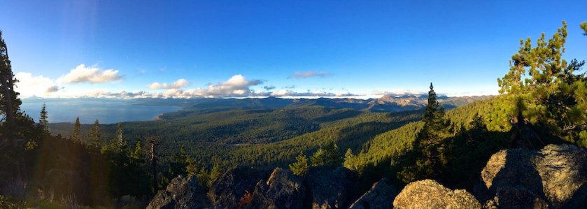
As I crest the peak I see my first view of Lake Tahoe and its simply beautiful. The sun is rising over its eastern shore and I stop and look and absorb this moment. Its easy to be so hurried on an activation to forget what else is at the top of a mountain.

The trail in and out is really a very up market 4×4 trail that a Jeep could easily have traversed. The pine trees along the way are laced with moss adding to the Hobbit like nature of this forest…damp, cold but not in the least spooky.


40m and 20m were reasonable despite the pretty low sunspot numbers for the day. I managed to make contact with many familiar and faithful chasers and one highlight was a contact all the way out to New Hampshire possibly 2,800 miles with AC1Z. Its wasn’t the easiest of contacts but it still reminds me of the magic of radio.
| Time | Call | Band | Mode | Notes |
|---|---|---|---|---|
| 15:27z | K6HPX | 7MHz | SSB | 47 TX and 51 RX |
| 15:28z | NG6R | 7MHz | SSB | 58 TX an 54 RX |
| 15:30z | WA7SB | 7MHz | SSB | 53 RX and 56 TX |
| 15:32z | W7RV | 7MHz | SSB | 58 TX an 54 RX |
| 15:36z | K7ANT | 7MHz | SSB | 57 TX and 55 RX |
| 15:37z | W7CNL | 7MHz | SSB | 36 TX and 57 RX |
| 15:38z | K6EL | 7MHz | SSB | 57 TX and 22 RX |
| 15:40z | W0ERI | 14MHz | SSB | 57 TX and 55 RX |
| 15:41z | W0MNA | 14MHz | SSB | 57 TX and 55 RX |
| 15:42z | VE6CCM | 14MHz | SSB | 57 TX and 55 RX |
| 15:44z | KA5PVB | 14MHz | SSB | 57 TX AND 33 RX |
| 15:45z | N4EX | 14MHz | SSB | 58 TX and 45 RX |
| 15:47z | WA2USA | 14MHz | SSB | 36 TX and 33 RX |
| 15:49z | AC1Z | 14MHz | SSB | 46 TX and 33 RX |
All in all a good start to my planned 5 activations.

Nice Paul! I will put this on my list if I am ever down in CA again. How do you do the activation zone circle? I like it!
LikeLike
Credit for marking the AZ in red goes to KU6J as I saw it on his web site. I use Garmin Basecamp and simply drew a red “track” at the minus 70 ft contour below the peak.
LikeLike